
Mapping coral reefs to study and help a critical ecosystem
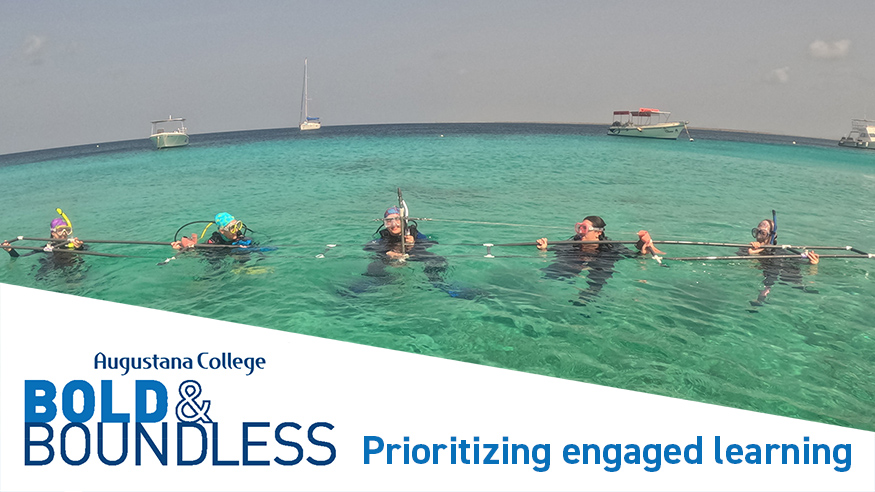
Community-based learning on a large scale: Augustana geology students travel with faculty to the Caribbean island of Bonaire to research environmental change in coral reefs.
2026-27 Catalog
JEANETTE C. ARKLE, Assistant Professor
B.S., B.A., M.S. California State University, Fullerton; Ph.D., University of Cincinnati.
CHRISTOPHER R. STRUNK, Professor
B.A., Wesleyan University; M.A., Ph.D., Minnesota
This experiential minor in geographic information science and technology is designed for students who want to enhance their chosen major with increased geospatial analysis skills and boost job marketability or graduate school preparation. The courses that are part of this minor are designed to provide students with (1)a broad base of knowledge and skills in GIST and (2) applied experiences using GIST in class projects. Students are also encouraged to complete a GIS-related internship during their Junior or Senior year.
Internships can take place on campus or off. On-campus internships will use GIS as part of student-faculty research collaborations or applied projects for the college. For off-campus internships, Augustana maintains connections with more than a dozen local agencies and companies that offer GIST internships, including the U.S. Army Corps of Engineers, U.S. Fish and Wildlife Service, USDA Natural Resources Conservation Service, and numerous county and city offices.
The Geographic Information Science and Technology Experiential Minor is 16 credits, distributed as follows: GIST 273 and GIST 475, and two of the following three GEOG 372, GIST 375 or GIST 376.
GIST 273 Introduction to GIS (4 Credits)
Maps are windows of information that allow you to explore your world – they visualize information about people and our natural landscapes, they allow for patterns to resolve, and they can materialize phenomena otherwise obscured. This course focuses on the use of a geographic information systems (GIS) to acquire, evaluate, and analyze spatial data. Students will learn (1) key concepts and components of GIS and (2) essential technical skills of operating a GIS with ArcGIS Pro software. Students will learn how geospatial thinking and methods can be applied to most disciplines and problems with applied exercises and projects on topics such as ecology, biology, geology, hydrology, public health, sociology, urban planning, environmental studies, business and more. There are no prerequisites for this course.
GIST 372 – Digital Cartography and Design (4 credits)
A cartographer can create a map that sparks curiosity, provides insight, spurs people to action, evokes change, or can even construct a map that triggers ideas and solutions toward a better future. This is an introductory course focused on the art and science of communicating spatial information. You will learn principles of cartographic design and specialized techniques to apply these principles, with both ArcGIS Pro and Adobe Illustrator software. Through several applied cartography projects, you will create some of the most utilized types of maps, you will learn to ethically manipulate and classify spatial data, and you will develop approaches to design maps that accurately and effectively communicate spatial information. There are no prerequisites for this course, but previous GIS knowledge is helpful.
GIST 375 – Drone Mapping and GIS
UAS (Uncrewed Aerial System or Drone) technology offers advantages and opportunities in a wide variety of careers and applications including surveying, infrastructure inspection and engineering, public safety, real estate, media and entertainment, science, forestry, geology, agriculture, urban planning, and many other civic fields. This intermediate-level GIS course focuses on learning the foundations of data collection and data creation through the applied use of drones for mapping and GIS analytics. Students will learn the flight safety and regulation standards of the Federal Aviation Administration (FAA), mission planning, photogrammetry, and applications of drone data in ArcGIS Pro software. These conceptual skills are applied to hands-on training and UAS flight experience gained through course projects.
GIST 376 – Remote Sensing & Imagery Analytics (4 Credits)
Imagery and remotely sensed data (data derived from drones, uncrewed aerial/aqueous vehicles (UAVs), satellites and more) are increasingly being used to transform static images into dynamic digital representations of our world. This intermediate-level GIS course will teach concepts and technical skills related to imagery and remotely sensed data in ArcGIS Pro software. Students will learn how to evaluate, create, and prepare GIS data derived from imagery and remotely sensed products. Students will also learn how to use analytics within GIS software to perform tasks such as terrain analysis, change detection, image classification, suitability modeling, 3D and multidimensional (space and time) analysis. Prerequisite: GIST 273 or consent from instructor. Offered in alternate years.
GIST 475 – Advanced GIS (4 Credits)
Advanced GIS is a capstone course for the GIST minor. The goal of this course is to teach students be an effective and independent GIS analyst, equipped with essential knowledge and technical skills necessary for graduate school or a professional career in GIS. Essential GIS skills that will be covered include applied data engineering of authentic datasets, advanced geoprocessing, critical examination of geospatial products, data validation, and design of strategies for learning new GIS skills and concepts. Prerequisite: GIST 273 or consent from instructor.
GIST-INTR – GIST Internship (0 to 4 Credits)
An internship that provides students with applied experience using GIST to meet needs or solve problems. Internships can be with Augustana faculty or staff members or with off-campus employers. Minimum of 80 hours. Internships must be approved by a GIST program coordinator. Prerequisites: GIST 273.
Community-based learning on a large scale: Augustana geology students travel with faculty to the Caribbean island of Bonaire to research environmental change in coral reefs.

Augustana students have been working with the Grand Caillou/Dulac Band of Biloxi-Chitimacha-Choctaw tribal community in Louisiana to develop a spatial database for use in planning how to restore the coast and mitigate rising water.

The public is invited to presentations at the John Deere Planetarium during the anniversary weekend to hear how Augustana alumni are leading and contributing to important work in their chosen fields today.